All across the world, emergency response providers use drones because they have special capabilities. Through their participation in several public emergency and safety actions, they have already saved hundreds of lives. Drone use for public safety has risen because of the 2020 COVID pandemic. Authorities in India employed drones to monitor cities and impose social distance regulations while mankind was facing a global shutdown. Drones are employed in a number of situations including public safety. However, there is one use case in particular that attracts attention since it offers clear advantages. We are referring to search and rescue as a critical use case in the field of drone technology.
Advantages of Drones for Search and Rescue (SAR)
Unlike other public safety activities, search and rescue missions may be quite challenging and unexpected. The total success of a SAR operation is significantly influenced by these two variables:
- Time: In the majority of SAR efforts, the missing individual is in a life-threatening circumstance with a limited amount of time. Therefore, it is crucial for rescuers to locate the victim as soon as possible.
- Terrain: SAR operations outside of human settlements may encounter difficult terrain, such as a snowy mountain, a jungle, etc., which might impede the operation as a whole.
In order to overcome obstacles in their job, SAR teams all around the world are adopting drones for the following reasons:
- Drones are fast: They can travel far farther and even visit regions that are inaccessible than ground-based vehicles can.
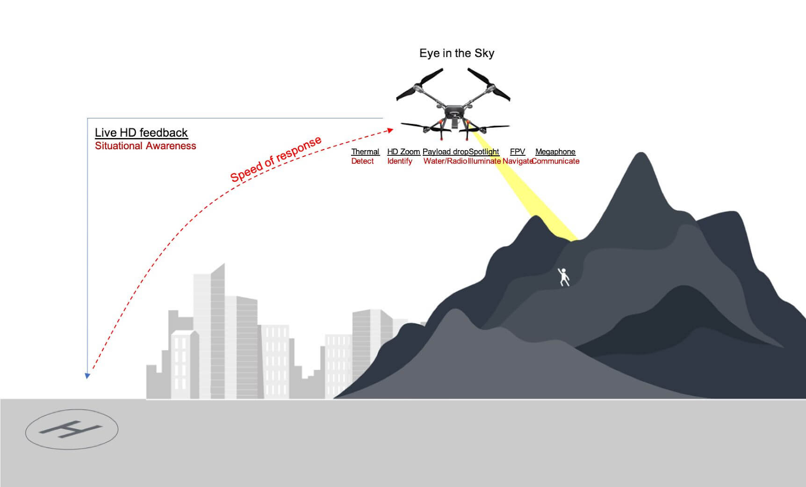
- Situational awareness: Access to aerial data over a sizable region is inexpensive and quick thanks to drones. Responders are then able to map the whole search area and identify potential hiding spots for the missing individual.
- Detect and recognise: Drones are equipped with a variety of sensors that may be used to recognise items on the ground. We will go through the specifics of how these sensors are employed in the following section.
- Communication: A drone with a loudspeaker on board can periodically broadcast a message alerting the missing individual that others are searching for him or her.
How drones are utilised in search and rescue operations: Method and applications
The capacity to quickly acquire aerial data in a vast region offers rescue teams the opportunity to move more quickly while searching for a missing person, where every second counts. This is the actual power that drones deliver to rescue operators.
What type of information is helpful during a search and rescue operation?
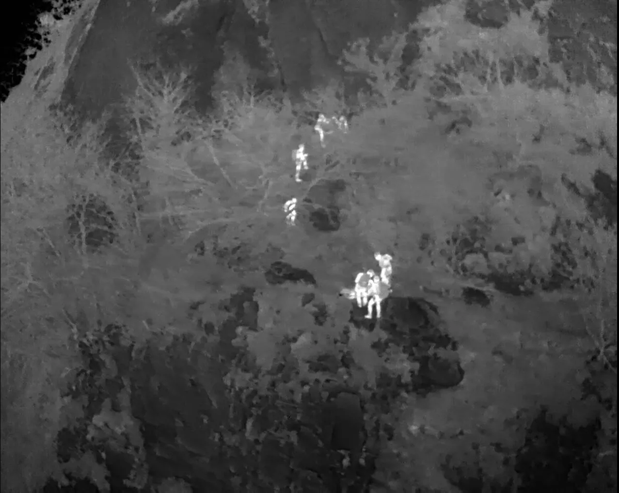
Different payloads that can be employed in various contexts can be carried by drones. The 4K wide-angle camera and the infrared camera are two common payloads that are frequently used during search and rescue missions. Since resolution is lost while viewing a still image, HD video from a drone is not very helpful in search and rescue operations. A high-resolution still photograph, however, might offer useful information to those on the ground who are searching for the missing individual. For this reason, high resolution still image-capable cameras are preferable.
Drones aided in NDRF’s rescue ops in Uttarakhand 2021 flash flood disaster
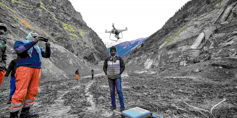
The rescue operations in Uttarakhand following the glacial burst which led to a flash flood were carried out by men and machines on the ground from various Indian agencies. However, a crew from Chennai-based business Garuda Aerospace aided the NDRF’s operations over the several days of the rescue mission when it came to activities in locations that were unreachable to personnel or large machinery. Each drone had a special ability of its own, including the ability to scan caves and tunnels, use thermal cameras, repair snapped power and communication lines, carry supplies like food and medicine, and even conduct assessments of the disaster site beyond lines of sight to help forecast future events. Over 170 people were still unaccounted for three days after the Uttarakhand catastrophe, so rescue crews stepped up their attempts to find the 25–35 men stuck in a sludge-filled tunnel using drones and remote-sensing technology.
Drones transporting medical supplies in disaster hit areas during the 2022 Assam floods
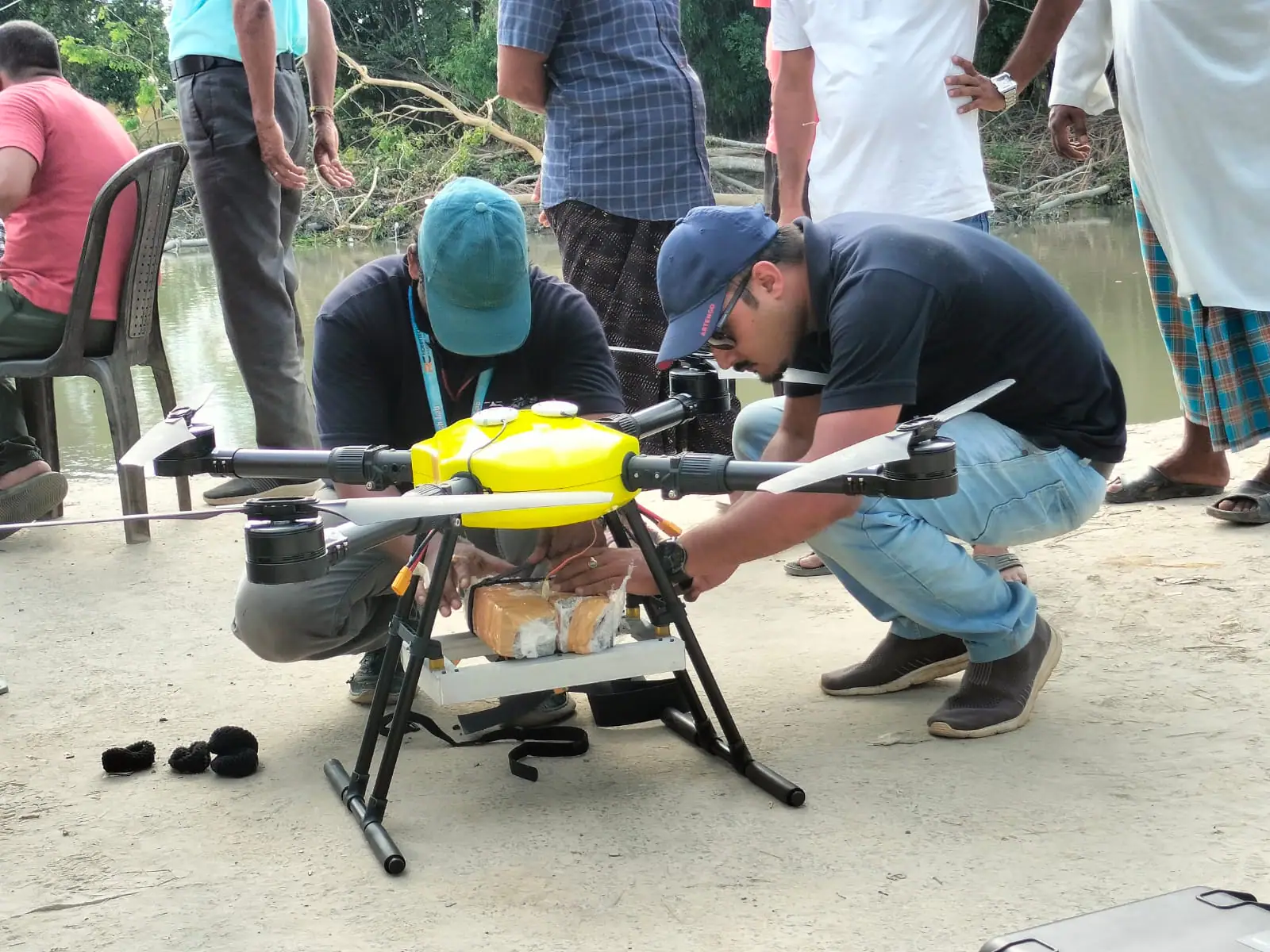
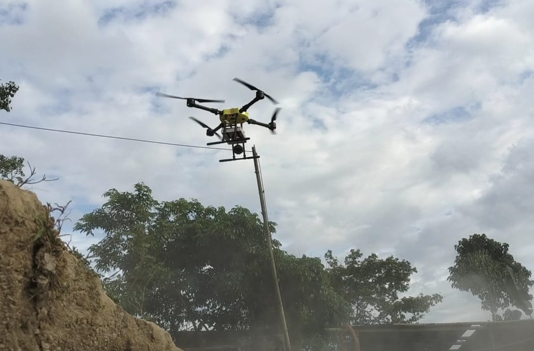
IIT guwahati deploying drones to flood hit areas
Drones were deployed by the Indian Institute of Technology, Guwahati (IIT-G) to deliver aid to those who were stranded in lower Assam’s floods. The monsoon’s rainwater runoff from the Bhutan Hills devastated the area and left hundreds of marooned peasants without food and shelter.
The entire operation was run by the “Drones Tech Lab,” a start-up from IIT Guwahati, together with members of the school’s aeromodelling club and with assistance from the Kamrup district administration. Since several villages in lower Assam, where IIT-G is located, were shut off from the rest of the state for weeks, they began delivering medications and relief supplies in Kamrup by drones. One of the worst-hit regions by the floods was Balisatra Chariali, close to Kendukona village, and IIT-G performed surveys and mapped the flood-affected areas there. Using drone technology, trapped persons during floods or other natural catastrophes like earthquakes and landslides were quickly located, and information was provided in real time to disaster response agencies.